The only easy way to get to the Las Vegas Motor Speedway is by spending over $500 for a one way trip by taking a helicopter flight. For everyone else there’s traffic concerns whether you are driving your own car or you buy a shuttle bus pass through Insomniac.
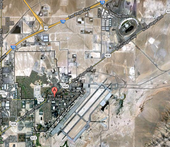
The shuttle bus service was better in 2012 than it was in 2011 and in 2013 it’s expected to be even better with the shuttle buses having a dedicated route. That route is going to use Nellis Air Force Base in some way. When looking at a map there are a number of options available, many of which will be aimed at bypassing North Las Vegas Blvd.
Pasquale Rotella had stated after Electric Daisy Carnival 2012 that this year the shuttles would have their own road to the festival after they had worked with a consulting company, Las Vegas police and Nevada Highway Patrol.
AWG Ambassador is the company providing the shuttle transportation and told the Las Vegas Review Journal that it is expecting to move 35,000 people each way. That’s a lot of people but still shows that there’s even more people driving their own cars.
Exactly which route will be taken? Looking closely at the map there’s a number of roads on and around the Air Force Base that could be used to bypass traffic. One possible options is Ellsworth Ave to O Bannon Rd to Bergstrom Ave would take the buses right to the back entrance of the speedway.
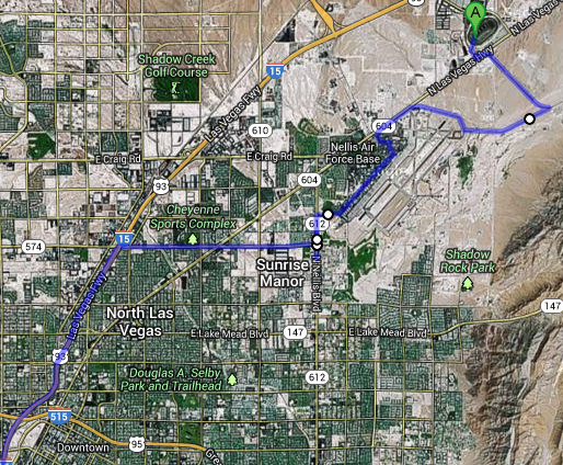
Update: The more likely route is for the buses to take a right onto N Las Vegas Hwy and then a left onto Speedway Blvd.

How will the buses get to that point of using the Air Force Base? From the Las Vegas strip they could take 15 to Cheyenne Ave towards the Air Force base and through the base from there. There are a number of options to get off the highway all of which will bypass the major traffic jams.
There’s plenty of other options as well and this is just one guess. We’ll all find out on Friday but until then half the fun is trying to figure it all out and see what the future holds. Open up Google Maps and share what you think could be the route!
Leave a Reply